
Construction Surveying Services
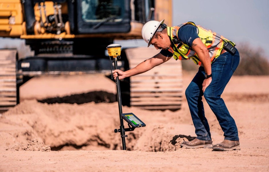
At SITECH Horizon, we stay on the cutting edge of innovation in all we do — including our GPS construction layout and land surveying services. For each construction project, it is crucial to begin with a detailed land survey. Using Trimble technology, SITECH Horizon can aid in solving some of the biggest challenges associated with construction site land surveying.
Surveying Services You Can Depend On
SITECH Horizon uses advanced software and GPS land survey equipment in Greensboro and Charlotte:
- Provide precise measurements of your jobsite's elevations, contours, structures and distances.
- Collect comprehensive data on natural features and built structures.
- Create a legally binding map of your jobsite.
- Establish property boundaries and place markers.
- Ensure your land mapping and project plans are in compliance.
- Help you create a 3D model of your construction site.
- Deliver reliable machine control models.
GPS technology enables our crews to perform fast, accurate construction layout and staking between sites. Real-time positioning gives you the information needed to build accurately and on schedule.
How Our Pre-Construction Surveying Services Enhance Your Projects
Construction surveying services offer the following advantages for your projects:
- Precise results: Construction surveyors mark the exact locations of your project's new roads, buildings or utilities so you can achieve precise results.
- Greater efficiency: SITECH Horizon's GPS construction layout and stakeout services help your team build faster with fewer errors, completing quality work in fewer passes. You can significantly boost efficiency, getting more work done in less time.
- Higher profits: Improving efficiency also increases profits. With detailed topographic maps, your team can generate more revenue while you reduce labor and material costs.
- Safety: Surveying services make your construction sites safer with accurate maps, data and models, helping you prevent potential accidents.
Sectors Leveraging GPS Surveying
The construction industry heavily relies on GPS land surveying due to its ability to provide fast, accurate results. Some of the primary sectors within the construction industry that leverage GPS surveying include:
Accurate construction data is vital at every level of commercial construction, as companies use data to create cost estimates and improve overall efficiency. With GPS land surveying, commercial site companies can easily make decisions to improve profitability.
Engineers and contractors in the roadwork and highway construction industries rely on accurate survey data. Quality GPS surveys create accurate models to aid in placing bids, planning projects and organizing resources. Since GPS is more precise than traditional construction surveying, it enables roadwork and highway crews to complete jobs faster, allowing drivers to regain road use more quickly.